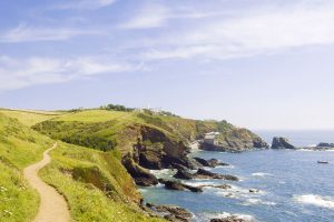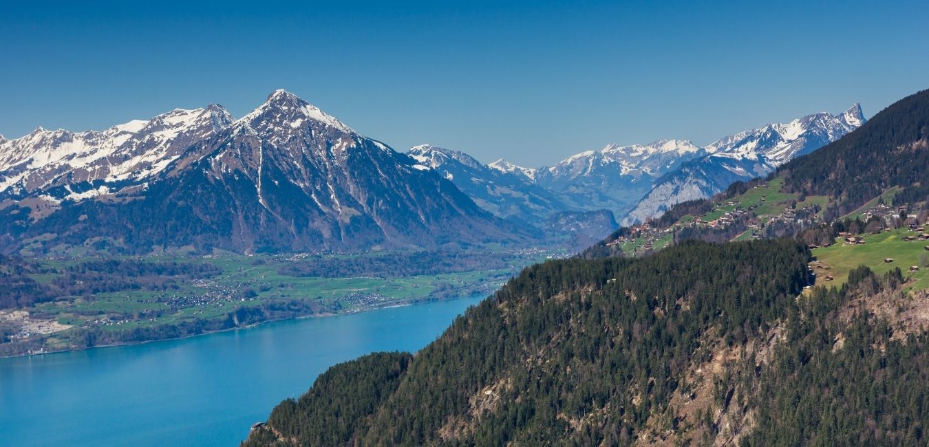
Known as the gateway to the Bernese Oberland, Interlaken is our favorite base for a Switzerland hiking adventure. The town sits between the azure-blue Lake Brienz and Lake Thun and is near many of the best hikes of the Bernese Alps. Since Interlaken is easy to reach and has efficient public transportation, you’re never far from an exciting trek.
With glacial lakes and snow-capped peaks in every direction, you’re spoilt for choice when hiking around Interlaken. Set up your base here, and you can easily spend weeks exploring dozens of trails. Some trailheads are close enough to reach by foot, and others are accessible by a short train/cable car ride. It really doesn’t get better than Interlaken when you travel to Switzerland for hiking.
Figuring out where to begin is often the trickiest task when planning a hiking trip in Interlaken. To help you get started, we’ve created an Interlaken hiking guide to find some of the area’s best trails. So, lace up your hiking boots and get ready for the adventure of a lifetime in Interlaken.
Where is Interlaken and how to get there?
Interlaken is centrally located in the Bernese Oberland region and has transport links from other major Swiss cities. You can reach Interlaken by train from Zürich, Geneva, Bern, Basel, major Swiss airports, and even international destinations.
Interlaken Ost is the town’s primary railway station, but Interlaken West is a smaller station nearby. There are train, bus, and boat transfers to popular areas around Interlaken from both stations. Although Interlaken is easily accessible by car, you likely won’t need an automobile once you arrive.
Get the SWISS TRAVEL PASS!
Experience seamless and unlimited travel across Switzerland’s trains, buses, and boats, making your journey as memorable as it is easy.
How to prepare for the Interlaken hiking trails?
With so many hiking opportunities at your fingertips, you want to prepare yourself for anything when hiking around Interlaken. Some of Switzerland’s toughest trekking routes course through Interlaken’s surroundings and push even veteran hikers to the max. Before tackling Interlaken’s brutal terrain, you want to check your backpack to ensure you’ve packed all your gear.
To help you prepare your packing list, refer to our Ultimate Switzerland Hiking Guide for the recommended equipment. It covers the proper clothing and gear needed for a safe expedition around Interlaken. Fortunately, Interlaken has several outdoor gear shops in case there’s something you need urgently.
Before you hit the trails, it’s wise to have a detailed paper map with you to use as a backup. Yellow covered hiking maps scaled at 1:50,000 are the ideal choice to study many trails around Interlaken. You’ll find maps for sale in book stores and kiosks at large train stations, and Interlaken has 2 major train stations in town. The Interlaken Tourist Office is a great location to visit for updates on trail closures, hiking conditions, and finding trailheads before you start trekking.
Interlaken trail map
5 best hikes around Interlaken
Interlaken is near many of Switzerland’s most daring hikes, and seasoned trekkers from around the world flock here. Unless you want to stay in a fairy-tale Swiss village, Interlaken is the country’s top hiking base. With so many treks accessible by foot or public transport, it’s easy to see why. To kick off your Interlaken hiking trip, start with these 5 trails for a thrilling adventure.
1. Faulhornweg: Schynige Platte – First

- Distance: 15.9 km
- Duration: 5-7 hours
- Difficulty: Moderate
- Starting Point: Cogtrain station of Schynige Platte
- Route Type: Point to Point
This Interlaken hiking trails brings you from Schynige Platte to First and is our overall top choice when hiking around Interlaken. For epic lakeside panoramas, it’s among your best bets anywhere in Switzerland. And with just under 1,000 meters of elevation gain, it’s not too strenuous for seasoned hikers. Your journey starts on a dirt path with stunning views of snow-capped peaks and evergreen firs along the horizon.
The real fun begins when the path opens up to the spectacular images of Lake Brienz. One of Switzerland’s prettiest alpine lakes enchants visitors with its azure-blue color and dramatic mountain backdrop. As you make the gradual ascent, you’ll face some rugged terrain but nothing too difficult to manage.
Before you reach the final destination at First, other must-see highlights include the summits of Oberberg and Faulhorn. The climb to each summit is worth the awe-inspiring 360° views of jagged peaks and alpine lakes engulfing the landscape. After the Faulhorn summit, you’ll amble beside the crystal-clear Bachalpsee and have a front-row seat to the Bernese Alps.
An important tip to know is that a cable car is available to transport you from First down to Grindelwald. Unless you feel like adding an extra 2 hours of hiking, we’d suggest starting your hike early and catching the cable car well before 5pm.
Map not loading? Click here or on the title of the trail on the right corner of the map, to get more information.
2. Hardergrat Hike

- Distance: 23.3 km
- Duration: 10-12 hours
- Difficulty: Hard
- Starting Point: Interlaken Harderbahn
- Route Type: Point to Point
The Hardergrat trail was bound to make our list, and this grueling journey is for serious hikers only! You’ll need to start the day before sunrise or keep a steady pace to finish at a decent hour. With an extraordinary vantage of Lake Brienz, you’ll trudge along the spine of a mountain range. Trekking on the ridge can be nerve-wracking, but the vistas here are among the best you’ll find in this alpine paradise.
Before you dare tackle this Interlaken hiking trail, we’d advise you to whip yourself into shape. Only fit hikers will be able to handle the brutal elevation gain and terrifyingly steep drop-offs. Don’t bother attempting the hike during rainy weather since the terrain will be too dangerous. In total, the Hardergrat hike ascends nearly 3,000 meters and pushes you to the limit.
While the ridgeline leads to Brienzer Rothorn, you can hop off the trail for a shorter version. But for troopers ready to venture onwards to Brienzer Rothorn, make sure you catch the last train down to Brienz. If you miss the ride, you’ll have to make an agonizing 1500+ meter descent from the ridge.
Map not loading? Click here or on the title of the trail on the right corner of the map, to get more information.
3. Morgenberghorn Hike

- Distance: 18.0 km
- Duration: 4-6 hours
- Difficulty: Hard
- Starting Point: Aescherid Schulhaus
- Route Type: Point to Point
Get ready for more lakeside panoramas whit this Interlaken hiking trail around the Morgenberghorn. Our first 2 hikes provide glorious views of Lake Brienz, but the Morgenberghorn trek offers a breathtaking vantage of Lake Thun. After briefly following a road, you’ll begin a steep climb through tranquil fields with snow-capped peaks looming above you. As the glistening shores of Lake Thun begin to appear, you’ll also have a dramatic vista of Eiger, Mönch, and Jungfrau with clear skies.
It’s a steady ascent to Morgenberghorn, and parts of the climb require a slight rock scramble. You’ll come across a set of chains drilled into the rocks that offer a boost onwards to the summit. The total ascent eclipses 1,200 meters, and your panoramic view from Morgenberghorn casts Lake Thun in the spotlight. Dramatic peaks of the Bernese Alps surround you in all directions, and you could spend an eternity snapping epic photos here.
Map not loading? Click here or on the title of the trail on the right corner of the map, to get more information.
4. Mülenen – Niesen Loop

- Distance: 17.5 km
- Duration: 5-7 hours
- Difficulty: Hard
- Starting Point: Mülenen Niesenbahn
- Route Type: Loop
Known as the “Swiss Pyramid,” Niesen gives hikers impressive views of Eiger, Mönch, and Jungfrau. While there is an inclined railway that can take you halfway up to Schwandegg, adventurous hikers will want to start from Mülenen. The full journey from Mülenen includes about a 1,700-meter incline, so prepare yourself for a steep climb.
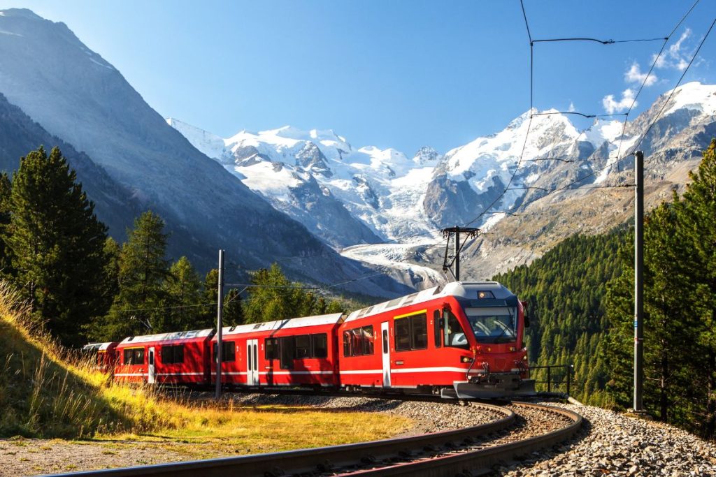
As you make the ascent, a jaw-dropping panorama of jagged peaks, alpine lakes, and lush greenery takes form. With good timing, you can take epic shots of the funicular slowly trudging up the mountain. Lake Thun sparkles directly below as the Bernese Alps and evergreen forests fill the backdrop.
If you end up hiking on a cloudy day, don’t be discouraged on this climb. Given its near-perfect pyramid shape, Niesen often pokes above the clouds during overcast conditions. On those days, standing at the Niesen summit feels like you’re floating on the clouds, and it’s a thrilling view. The Niesen Berghaus Restaurant sits at the peak, and you can refuel with a meal after the steep ascent of this Interlaken hiking trail.
Map not loading? Click here or on the title of the trail on the right corner of the map, to get more information.
5. Harder Kulm – Habkern via Augstmatthorn

- Distance: 16.4 km
- Duration: 5-7 hours
- Difficulty: Hard
- Starting Point: Harder Kulm
- Route Type: Point to Point
This Interlaken hiking trail offers another chance to experience the Hardergrat Ridge but with a lower intensity level. The total incline is just under 1,000 meters and shouldn’t faze seasoned hikers. But the trail does have some exposed drop-offs, and we wouldn’t recommend beginners tackle this route. You can reach Harder Kulm by funicular from Interlaken, and the trailhead itself offers sweeping views of the Bernese Alps.
As you trek along the ridge, you’ll have a fantastic vantage of Lake Brienz with sunny skies. On the ridge’s opposite side, beautiful forests and green fields fill the landscape. Snow-capped peaks soar above the horizon, and the 360° views are a marvelous spectacle with favorable weather conditions. Make the rocky climb up the Suggiture summit, and you’ll have a glorious vista of the Bernese Alps.
From Suggiture to Augstmatthorn, keep your eyes peeled for wildlife grazing near the ridge. There’s a good chance you’ll run into chamois or Alpine ibex, especially when no other hikers around. You’ll often spot them perched on the cliffside, and it’s mind-blowing how they can hang onto the steep slopes.
Once you reach the Augstmatthorn summit, it’s among the most dramatic views you can get around Interlaken while hiking. Standing on the steep ridge with the snow-capped peaks surrounding you feels like you’re on top of the world. After soaking up the views from Augstmatthorn, the final leg of your journey is a steep descent towards Habkern.
Map not loading? Click here or on the title of the trail on the right corner of the map, to get more information.
What else to do in Interlaken?
Interlaken is an outdoor enthusiast’s paradise, and there are tons of activities waiting for you want to explore the area in a different way than hiking. With 2 glacial lakes serving as Interlaken’s neighbors, there are plenty of excursions on the water. And the jagged cliffs provide more exhilarating experiences when you’re off the hiking trail.
Don’t forget about the friendly skies above and find out how Interlaken entertains visitors wishing to fly.
Kayaking on Lake Brienz

When your legs need a break off the trails, consider booking this kayak tour of the turquoise Lake Brienz. Enjoy Interlaken’s splendor from the deep-blue water as you paddle around this beautiful setting for 3 hours. The soothing sound of Lake Brienz’s waves creates unmatched tranquility as you explore Interlaken from the water.
You’ll drift by the medieval Ringgenberg Castle, along the River Lütschine, and gaze at the rugged cliffs above you. With your arms doing the work for a change, kayaking is an exciting alternative to discover Lake Brienz before your next hike.
Canyon swing in Grindelwald

This 2.5-hour canyon swing will send you on a death-defying freefall between the canyon walls in Grindelwald. At 90 meters high, you’ll race at speeds upwards of 120 km/h through the canyon. The picturesque journey to the glacier canyon offers stunning images of the Eiger, Mönch, and Jungfrau peaks. Before you take the plunge, admire the rock galleries and tunnels carved by the Grindelwald glacier.
Skydiving over Interlaken

If you’re a true daredevil at heart, then this helicopter skydiving experience is right up your alley. The once-in-a-lifetime thrill ride flies you high above the Swiss Alps and lets you free fall over the snow-capped peaks. You’ll join a highly-trained tandem master and can admire the majesty of the Bernese Oberland 15,000 feet in the sky.
The 2-hour expedition begins with an intro video, ground practicing, and gear check before takeoff. Once you enter the free fall, it’s a jolt of adrenaline as your helicopter fades in the distance. With your tandem master, you’ll be surrounded by epic mountain scenery before gently landing in the valley below.
We love to hear from you
Thanks for checking out our Interlaken hiking guide. Hopefully, this has provided the information you need to plan an adventurous trekking vacation in Switzerland. If you have hiking experiences from Interlaken or other tips to recommend, please leave a comment below.
For more information about Switzerland, please visit this Switzerland Travel Page. Or check our travel tips for more general travel information!