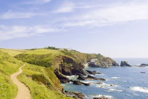
Before you go hiking in iceland
As you may already know in Iceland the weather can change in 5 minutes, and so you can have all seasons in just one day. So be prepared to bring a rain jacket and warm clothes with you during your hike. Please don’t bring an umbrella or poncho as the wind can be really strong in Iceland.
It’s not only the water and windproof clothing but also make sure you are wearing the right waterproof footwear. Not only waterproof but as the paths in Iceland can be rough as in lava rocks you need proper and I would suggest higher shoes.
Iceland is amazing especially for hiking and biking in my opinion, for this reason I made a list of the best trails for hiking North Iceland. Below you will find some shorter hikes for max 5 kilometers, followed by some day hikes between 5 and 15 kilometers and at least you will find 3 amazing multiple day hikes.
Best time to go hiking in iceland


When hiking in Iceland, nothing beats the midnight sun and having daylight for nearly 24 hours. Iceland’s northerly location near the Arctic Circle produces dramatic amounts of daytime during summer. And this extended period of daylight also provides warmer temperatures that are much more comfortable for hiking. Iceland isn’t known for balmy temperatures as July has average highs around 57°F (14°C), and August has average highs around 55°F (13°C).
And the height of summer is the best time to visit Iceland to guarantee access to all its best hiking trails. Iceland’s weather is extremely unpredictable, and some paths close outside of the summer months. And the worst part, it’s the most jaw-dropping hikes that close when the temperatures drop and days become shorter. For instance, June to early September is the only time you can reach the Icelandic Highlands. So, if you’re going to Iceland specifically for hiking, we highly recommend July or August for the best experience.
What to bring when hiking in iceland
An Iceland hiking vacation brings you face to face with some of the world’s most diverse landscapes. Before embarking on your adventure, it’s imperative to prepare yourself for anything. As we’ve mentioned, Iceland’s weather can be insane and change at a moment’s notice. And when there are zero facilities around, missing items from your packing list can put you in a critical situation. Here’s what we recommend you pack before hiking in Iceland:
- Backpack – A 30 to 40 liter backpack should be enough space to carry your supplies on day hikes. But if you’re planning on multi-day treks, then plan on bringing a 55 to 65 liter backpack for extra gear. Make sure you choose a hiking backpack with waist support to relieve the tension from your shoulders. Also check out our buying guide to the perfect backpacking backpack to know exactly what to look out for when purchasing one.
- Waterproof Backpack Cover – In case it rains, you don’t want the gear inside your backpack to get soaked.
- Water Bottle – Bring a 1-2 liter bottle that can be filtered. Tap water and many natural sources are fine to drink. But if you’re uncomfortable drinking water out in nature, you can always filter it to be safe.
- Navigational Tools – Pack a paper map, compass, GPS, or combination of the three. Don’t strictly rely on your phone’s GPS and always have a backup.
- First Aid Kit – Stock your kit with bandages, anti-inflammatories, antibacterial ointment, antiseptic wipes, medications, adhesive tape, and anything else specific to your needs.
- Mobile Phone – Save important Icelandic phone numbers in case of emergencies. It would also be a smart idea to buy an Icelandic sim card and portable charger for your phone.
- Multifunction Knife – A knife comes in handy for a variety of utility purposes to get you out of a jam.
- Whistle – If you’re stuck in an isolated section and can’t call out for help, you want a whistle to signal others far away.
- Headlamp – If you’re in the wilderness in the dark, a headlamp is a must to observe your surroundings and to find your way around camp.
- Toiletries – Toothbrush, toothpaste, deodorant, lip balm, and anything you need to refresh between hikes.
- Eye Shades – In case you have difficulty sleeping beneath the midnight sun.
- Sunscreen & Sunglasses – For protection against UV rays during the extended hours of sunlight.
- Spare Food & Water – Only to be used for emergencies in case your hike takes longer than expected.
- Sturdy and waterproof hiking boots – It’s easy to get your boots wet when hiking in Iceland, and you don’t want your feet inside wet boots for a long time. Also check the profile of the shoes to make sure you have enough grip on the rough Icelandic surfaces.
- Trekking Poles – Not everyone requires them but they help provide stability on difficult trails.
- Camera – To capture breathtaking photos to show your loved ones.
Camping Gear


Iceland has thrilling multi-day treks that require camping gear to include with your packing list. If you’re planning on a multi-day hiking excursion, also include these items:
- Sturdy Tent – Ensure your tent has a solid foundation to remain standing against strong winds.
- Cooking Supplies – Nothing fancy but a small, lightweight camping stove and an easy way to light it.
What to wear when hiking in iceland
When hiking in Iceland, you have to dress for all weather conditions. The forecast can change in a heartbeat, and you need several essential pieces of clothing to survive the elements. Here’s a list of what you need to wear while hiking in Iceland:
- Several Thin Layers – Give yourself the ability to adjust your outfit based on the current weather conditions. If you need help maintaining a healthy body temperature in extreme environments, check out our guide on the layer system.
- Waterproof Hiking Boots – You’ll make lots of water crossings and need waterproof boots with good tread.
- Gaiters – In case you have to trek through snow or water.
- Waterproof Jacket – The weather can be unpredictable and hiking in cooler temperatures in the rain is a recipe for hypothermia.
- Wool/Fleece Jacket – An added layer of protection for the evenings when the temperature drops.
- Hiking Socks – Bring socks that keep your feet comfortable, warm, dry, and blister-free. Merino wool socks are a great option for any Iceland hiking trip.
- Waterproof Pants – Pack trousers that provide comfort, warmth, and freedom of movement while keeping you dry.
- Thermal Underwear – An extra layer for cooler temperatures at higher altitudes.
- Waterproof Gloves – Prevent your hands from being exposed to frigid temperatures and rainy weather.
- Scarf or buff – An extra layer to protect your face and neck in cold weather.
- Hat/Beanie – Protect your head, face, ears, and neck from cold temperatures and fierce wind.
- Towel – To dry off if you get wet on the trail or after relaxing in the hot springs.
- Spare Clothes – Always pack at least one change of dry clothes for each hike.
Best short hikes in iceland
1. Godafoss Waterfall

- Distance: 2.9 km (1.8 miles)
- Elevation gain: 92m
- Duration: 1 hour
- Difficulty level: Easy
- Kind of trail: Out & Back
- Starting point: Near Þingeyjarsveit
This is an easy hike and as Godafoss is one of the most popular waterfalls it’s very nice to explore this area by foot. The hike is well maintained and most of the roads are from gravel, you will cross a really photogenic bridge. You can see the waterfall from different viewpoints, even from the cafe you can enjoy the waterfall to the fullest.
Click here or on the title of the trail on the right corner of the map, to get more information.
2. Dettifoss Waterfall – West Side

Distance: 3.5 km (2.2 miles)
Elevation gain: 95m
Duration: 1 hour 10 min
Difficulty level: Easy
Kind of trail: Out & Back
Starting point: Near Husavik
The Dettifoss waterfall located in Vatnajökull National Park is well known as the second most powerful waterfall in Europe, after the Rhine Falls in Switzerland. Dettifoss is part of the Diamond Circle, an amazing route in the north of Iceland. From Dettifoss you can walk to the other waterfall called Selfoss. The path is good but when it snows or rained make sure to wear waterproof boots.
Click here or on the title of the trail on the right corner of the map, to get more information.
3. Hverfjall Volcano Crater

Distance: 4.2 km (2.6 miles)
Elevation gain: 0m
Duration: 1 hour 5 min
Difficulty level: Moderate
Kind of trail: Loop
Starting point: Near Vogar
Hverfjall is a unique volcano because of its round shape, it’s one of the world’s circular volcanic craters. It’s really one of the must stops when you are driving in the Myvatn Area. From the parking lot the hike starts easy. After the climb is steep up to the top of the crater ridge, keep in mind that it will be windy and it can be cold! You can walk all around the crater in roughly 1 hour. You have incredible views over the Myvatn lake from the top.
Click here or on the title of the trail on the right corner of the map, to get more information.
Read also: The complete hiking guide to the Laugavegur Trail in Iceland
4. Dimmuborgir: Kirkjan Cave – Hallarflöt

Distance: 4.3 km (2.6 miles)
Elevation gain: 87m
Duration: 1 hour 15 min
Difficulty level: Easy
Kind of trail: Loop
Starting point: Near Skútustaðahreppur
Close to Myvatn you will find Dimmuborgir, a huge area of uncommonly shaped lava fields. Dimmuborgir means dark castles and if you are a Game of Thrones fan, also this area is used in the populair serie. The Hallarflöt hole is a famous hole in the lava and really a stop during your hike. The path is well paved and makes sure that there can be a lot of mosquitos in this area. You won’t find any shade during this hike so also wear a hat, this is the case with a lot of trails while hiking north Iceland.
Click here or on the title of the trail on the right corner of the map, to get more information.
5. Aldeyjarfoss Waterfall

Distance: 2.3 km (1,4 miles)
Elevation gain: 73m
Duration: 44min
Difficulty level: Easy
Kind of trail: Out & Back
Starting point: Near Skútustaðahreppur
The waterfall called Aldeyjarfoss is located along the Sprengisandur Highland Road, so you start your adventure of Iceland highlands hiking. As you may have already noticed Iceland has a lot of basalt columns on the coast side but also inland and this waterfall is unique because of the columns. During the hike you have a lot of wild flowers in spring and during summer.
A little side note, to get as close as possible you really need a 4×4, during summer you can get to 500m distance from the waterfall with a normal car. Tip: Don’t forget to visit Ingvarafoss a little further as well. If you cross a fence for the sheep, please make sure to close it properly after you pass.
Click here or on the title of the trail on the right corner of the map, to get more information.
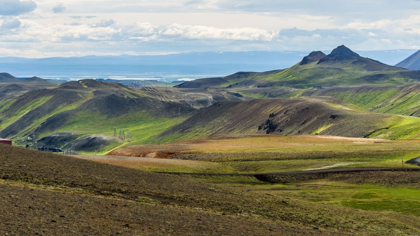
6. Krafla

Distance: 4.0 km (2,5 miles)
Elevation gain: 55m
Duration: 1 hour 10 min
Difficulty level: Easy
Kind of trail: Loop
Starting point: Near Skútustaðahreppur
This easy hike will give you different kinds of formations and what I liked the most was the contrast between the dark lava rocks and the green mountains. Walking between the lava rocks with the smoke makes it a great experience, be aware of the egg smell from the smoke. The trail will lead you all the way up to the crater. You can combine this trail with the short trail Leirhnjukur, if you are a fan of Lord of the Rings, this is yours.
Click here or on the title of the trail on the right corner of the map, to get more information.
Don’t miss: The Ultimate Guide to hiking in Iceland (included Iceland hiking trails map)
7. Leirhnjúkur Lava Field

Distance: 4.8 km (2,9 miles)
Elevation gain: 102m
Duration: 1 hour 25 min
Difficulty level: Moderate
Kind of trail: Loop
Starting point: Near Skútustaðahreppur
Next to Krafla you will find the lava field of Leirhnjúkur, a really ridiculous place all covered by dark lava rocks. Also this area is part of the Diamond Circle and closeby Myvatn Lake. Also for this hike be prepared in summer months for the mosquitos. I have to say I cycled for 3.5 months in Iceland also during summer and never noticed the huge amount of the little animals. A part of the hike is a boardwalk. Be aware of some missing parts, but the most important part is enjoy!
Click here or on the title of the trail on the right corner of the map, to get more information.
8. Húsavíkurfjall (Húsavík Mountain)

Distance: 3.9 km (2,4 miles)
Elevation gain: 408m
Duration: 1 hour 52 min
Difficulty level: Moderate
Kind of trail: Point to Point
Starting point: Near Norðurþing
The panoramic view of Skjálfandi Bay at the summit of the Husavik Mountain (Húsavíkurfjalln) is fantastic and makes the steep climb so worth it. When you look east you will see the black deserts towards Myvatn and when the sky is clear enough you can even see the lake of Botnsvatn. Husavik is a popular place for locals and tourist, so really when you are in the area stretch your legs, pack a small backpack and enjoy the hike. If you want to enjoy a traditional Whale Watching your in Husavik, click here to see my favorite tour.
Click here or on the title of the trail on the right corner of the map, to get more information.
North Iceland Day Hikes
Below you will find an overview of the best day hikes in Iceland Northern part.
9. Klappir Ásbyrgi Canyon

Distance: 7.1 km (4,4 miles)
Elevation gain: 276m
Duration: 2 hour 55 min
Difficulty level: Moderate
Kind of trail: Out & Back
Starting point: Near Norðurþing
The Asbyrgi canyon was for me a huge surprise while cycling in Iceland, as you won’t find any trees and there you will find a huge forest. This horse-shoe shaped canyon is a dried up gorge and is part of Vatjnajökull National Park. The walking track will lead you to Klappir where you will find the wonderful Botnsjörn waterfall. When you are on the edge of the canyon you have a spectacular view overlooking the canyon and lakes. But remember if you want to enjoy the viewpoint you will encourage a steep climb, but on this trail you have the support of a stairs and a rope.
Click here or on the title of the trail on the right corner of the map, to get more information.
Also read: The complete route guide of the Golden Circle in Iceland + Map
10. Rauðhólar Circle


Distance: 5.1 km (3,2 miles)
Elevation gain: 135m
Duration: 1 hour 35 min
Difficulty level: Moderate
Kind of trail: Loop
Starting point: Near Húsavík
If you are into basalt rock formations then this is your trail. I recommend going clockwise as this gives you an easy path on the west side and a bit more technical path on the east. As the name Raudholar means red hills you will be surprised by the colorful hills and the scenery around the hills are incredible.
Click here or on the title of the trail on the right corner of the map, to get more information.
11. Vindbelgjarfjall

Distance: 5.1 km (3,2 miles)
Elevation gain: 310m
Duration: 1 hour 59 min
Difficulty level: Moderate
Kind of trail: Out & Back
Starting point: Near Skútustaðahreppur, next to the farm Vagnbrekka
On the western shore of lake Myvatn you will find Vindbergjarfjall, also known as Vindbelgur Mountain. The starting point is next to the farm called Vagnbrekka where you also find a car park. When you reach the top of the mountain you will be rewarded with spectacular views. While the hike starts easy and flat when you reach the mountain, that’s the moment the steep uphill climb will start. But as said before the view over the lake, craters and the scenery in the Myvatn area is worth it.
Click here or on the title of the trail on the right corner of the map, to get more information.
Check out: Ultimate car rental guide for Iceland
12. Hrisey Red Trail

Distance: 6.6 km (4,1miles)
Elevation gain: 104m
Duration: 1 hour 53 min
Difficulty level: Easy
Kind of trail: Loop
Starting point: Near Akureyri
Allright first you have to reach the island via the Ferry which will go from the village Árskógssandur, on the west coast of Eyjafjörður. The ferry goes every two hours and the journey will take just 15 minutes. If you are situated in Akureyri you can take the bus to the ferry. For tickets and times check out this website.
The red loop is a little advanced where the tracks are narrow, you will challenge some uphill and downhills. You will have the feeling of being alone on earth while you are enjoying this hike and the views across the fjords are significant. You can combine the green track and the red trail.
Click here or on the title of the trail on the right corner of the map, to get more information.
13. Kofi Trail

Distance: 5.5 km (3,4 miles)
Elevation gain: 251m
Duration: 1 hour 56 min
Difficulty level: Moderate
Kind of trail: Out & Back
Starting point: Near Dalvíkurbyggð
Dalvik is a town in the north you will love for sure. Set directions to the church and park your car, put on your shoes and start your hike. As this is a really popular starting point for multiple hikes, make sure to follow the right path. As you want a more advanced trail than pick the hike from 11 kilometers but be aware to do some river crossings on this track.
Click here or on the title of the trail on the right corner of the map, to get more information.
Must Read: The Ultimate Golden Circle Iceland Guide All You Need to Know
14. Askja


Distance: 6.6 km (4,1 miles)
Elevation gain: 165 m
Duration: 2 hour 5 min
Difficulty level: Easy
Kind of trail: Out & Back
Starting point: Near Skútustaðahreppur
I will never forget the Askja area, as I had to cross rivers and put my warm clothes on late in the summer season. From the carpark the hike is pretty easy and well marked, the path is mainly gravel and at the end you can expect some mud or clayish ground. When you want to swim make sure to wear proper footwear as the downhill walk to the lake is from losen rocks and can be steep. The water in the crater will be around 25 degrees so really worth taking a dive.
Click here or on the title of the trail on the right corner of the map, to get more information.
Multiple day hikes north iceland
Before you start your multi day hike or even a day trip make sure to check out the SafeTravel app which provides actual road and weather safety information in Iceland. For multi day hikers I would recommend to fill in a travel plan so the rescue team knows where you are located.
15. Lake Myvatn Loop

Distance: 36.4 km (4,1 miles)
Elevation gain: 739 m
Duration: 10 hour 44 min
Difficulty level: Moderate
Kind of trail: Loop
Starting point: Near Skútustaðahreppur
From the village of Reykjahlíð you start your loop all around the Myvatn lake. I would say the loop is easy with a lot of short trails passing by so you will have some parts more crowded than others. During the whole loop you don’t have to think about services as you will find all services around the lake. You can enjoy incredible views and the difference between the highest point and lowest is just 38 meters so I would say low fitness level all fine.
Click here or on the title of the trail on the right corner of the map, to get more information.
16. Akureyri – Laugafell – Hjólafall

Distance: 140.5 km (87,3 miles)
Elevation gain: 3.907 m
Duration: 43 hour 45 min
Difficulty level: Hard
Kind of trail: Loop
Starting point: Near Eyjafjarðarsveit
This great multi day hike starts from the end of the fjord in Akureyri to the cabin and warm/hot rivers in Laugafell. So make sure to bring your swimwear while hiking this trail. On your way back you set directions to Hjólafjall. This part of the track is well known for the amazing views. Make sure to bring some extra water with you as this part of Iceland is more dry than you used to. If you want to do relax after this hike and are interested in whale watching check out this guide.
Click here or on the title of the trail on the right corner of the map, to get more information.
17. Diamond Circle

Distance: 285 km (177,9 miles)
Elevation gain: 4.725 m
Duration: 81 hour 45 min
Difficulty level: Easy
Kind of trail: Loop
Starting point: Near Þingeyjarsveit
Most of the tourists are talking about the famous Golden Circle, but did you know there is also a Diamond Circle in Iceland? This circuit will show you a lot of amazing sides during the 250 km loop you will pass waterfalls, lakes, canyons, sea cliffs, columnar rock formations, volcanic craters and so much more. You can also drive this circuit by car, read here everything you need to know about renting a car in Iceland.
Click here or on the title of the trail on the right corner of the map, to get more information.
Best Iceland hiking tours
Check out below the best Iceland hiking tours to make sure you made great memories and have the right gear and guides with you.
FAQ Hiking North Iceland
What is the best time to hike in Iceland?
The most popular months for hiking are June, July and August as you have linger days and the best weather conditions. If you prefer to have some more adventure but unpredictable weather you can go hiking in the edges of the seasons like from May til mid-June and from late August to mid-October. The explore adventure in winter is also possible but please this is not for everyone and always make sure to check the conditions before and during your trip.
How difficult is hiking in Iceland?
The main challenge for hiking in Iceland is the steep climbs and definitely the weather changes.
Is hiking in Iceland safe?
The main challenge for hikes in Iceland is the steep climbs and definitely the weather conditions which can change in minutes. My biggest challenge while hiking and biking in Iceland was absolutely the strong wind.
Do you need a permit to hike in Iceland?
You don’t need a permit to hike in Iceland, but booking a hut is necessary.
Can you hike anywhere in Iceland?
There are hiking trails everywhere in Iceland and it’s pretty easy to find one in your current location via the Alltrails app.
What are the best hikes in Iceland?
The 6 best hiking areas Landmannalaugar, Reykjavik, Westfjords, LKake Myvatn, Snæfellsnes Peninsula and the East Fjords.
Pin for Later