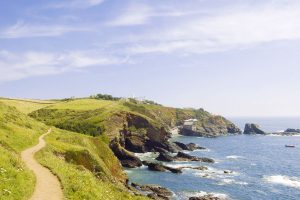
Hiking Faroe Islands is an out of this world experience, and any adventurous trekker would have a blast discovering its untouched scenery. The North Atlantic archipelago offers everything from mesmerizing lakes and steep climbs to heart-racing cliffside vistas.
We had the chance to visit the Faroe Islands during one of the rainier times of the year, but we still managed to tackle some of the country’s best trails. There are plenty of short treks that take just a few hours, but serious hikers will find some multi-day routes to escape the crowds.
After our 10-day road trip around the Faroe Islands and getting a taste of the superb hiking the country has to offer, we’re thrilled to share some of our favorite routes. Read below to find out 5 of the most incredible hikes in the Faroe Islands and plan your next trekking expedition.
video: best hikes in the faroe islands inspiration
Best time to hike in the Faroe Islands
- Best months for hiking Faroe Islands: June – August
The dramatic landscapes of the Faroe Islands are a hiker’s paradise, and the 18 islands of the archipelago have many thrilling treks. However, not all seasons in the North Atlantic Ocean provide suitable hiking conditions. For the best hiking experience in the Faroe Islands, it’s important to schedule your trip at the right time of year.
Warmer temperatures, less rainfall, and more sunlight are the things you’re looking for to make the most of your hikes in the Faroe Islands. The summer months provide adequate hiking conditions and are the best time to visit the Faroe Islands if hiking is your top priority.
Summer days in the Faroe Islands are over 20 hours long, and the weather conditions are the most stable this time of year. May to August receives the least rainfall, while July and August are the two warmest months of the year. The maximum temperatures at the peak of summer are usually around 13-15°C, depending on your location.


With that being said, don’t expect the weather to always cooperate just because it’s summer. The Faroe Islands are notorious for weather forecasts that change in a heartbeat, and it’s common to experience all four seasons in one day. In general, the climate is cold and rainy most of the year, and there are plenty of cloudy days during summer.
It’s crucial to bring proper hiking boots with quality traction since less-developed trails can easily become muddy and unstable. Fortunately, many of the best Faroe Islands hikes don’t take long to reach, and you’ll witness some of the most jaw-dropping seaside vistas in the world.
Faroe Islands temperatures
| Min °C | Max °C | Rain mm | |
| January | 1 | 5 | 165 |
| February | 1 | 5 | 119 |
| March | 1 | 5 | 144 |
| April | 2 | 7 | 98 |
| May | 4 | 9 | 75 |
| June | 7 | 11 | 72 |
| July | 8 | 12 | 86 |
| August | 8 | 12 | 93 |
| September | 7 | 11 | 153 |
| October | 5 | 9 | 187 |
| November | 2 | 6 | 158 |
| December | 1 | 5 | 171 |
Hiking safety tools for the Faroe Islands

Hiking Faroe Islands can be unpredictable, and it’s imperative to prepare yourself for anything. The Faroe Islands are dotted with cozy villages, and many hiking paths connected residents before the invention of automobiles. There are often landmarks, such as Torshavn, that point you in the proper direction on these hikes.
However, other paths venture outside the villages towards mountains and sea cliffs that offer breathtaking panoramic views of the ocean. It’s easy to get lost if you’re not careful, and inexperienced hikers should hire a local guide to avoid wandering into dangerous situations.
For seasoned trekkers, we still recommend having the proper tools that will point you in the right direction on each trail. Whether you use a guidebook or our trusty Spot Gen 3 that’s with us on every trip, bring whatever resources you need for a safe journey.
The Spot Gen 3 has extremely valuable safety functions such as GPS tracking, check-in to let contacts know you’re okay, help/spot to request help at your location, and an S.O.S. signal in case of emergencies. We always carry it with us to ensure our loved ones can find our location under any circumstances.
How to prepare for hiking Faroe Islands
Wearing the proper attire is another critical factor to stay safe on each hiking trail in the Faroe Islands. As we mentioned, the weather can be quite fickle, and you might experience all four seasons in one day.
Your hiking attire should include:
- Comfortable hiking pants
- Thermal and wool layers
- Wind and waterproof material
- Hat and gloves
- Sturdy hiking boots
- Toasty jacket
In addition to having the right attire and gadgets, stay informed about your surroundings during your visit. Find out the length and difficulty of each trek on your itinerary, check the weather forecast before you leave, and ask the locals if any activities might interfere with your plans.
Before departing, it’s wise to inform someone where you’re going and to always bring your hiking buddy with you. Once you’re on the trail, stick to the path to avoid getting lost and don’t put yourself in a dangerous predicament just to get a cool picture. Trust us; there will be many opportunities for epic snapshots to add to your collection. It’s really important to wear the best hiking boots when hiking the Faroe Islands, so make sure to pack the right boots for your trip.
We would also like to mention how important it is to be a responsible hiker and take care of the landscape for future travelers. Never leave trash behind on the trails, stay on designated paths to avoid damage to the environment, and don’t alter landmarks that locals have used for centuries to get around. Make sure to follow the hiking restrictions as mentioned on this website.
Faroe Islands hiking fees
As the Faroe Islands are getting more populair over the years there are some hiking trails you have to pay for, or you are not allowed to walk the trail without a guide. As I was there in 2017 and the Islands were really unknown I didn’t had to pay any kind of fee. For more information about the fees and information about the hikes download this PDF.
Faroe Islands hiking map
5 Best hikes in Faroe Islands
1. Kallur Lighthouse

The Kallur Lighthouse hike was our favorite, and this scenic location might be the most dramatic view anywhere on the Faroe Islands. While the lighthouse itself isn’t impressive, it sits directly beneath a rugged sea cliff that makes you feel on top of the world. Lush, green landscape adorn the cliffside, and the climb to the peak is an enchanting endeavor.
Other than the elevation gain of nearly 1,000 feet, this Faroe Islands hike is tame compared to others around the archipelago. Weather conditions will play the biggest factor when trying to conquer the summit just past the lighthouse. Windy, foggy days make the path too dangerous due to the risk of following over the edge.
To reach the starting point of the trail, you should know that the island of Kalsoy requires a ferry. If the capital Tórshavn is your base, you need to drive about 1 hour and 10 minutes to Klaksvík to catch the ferry. The ride takes about 20 minutes to Syðradalur, but there’s often a long line during the summer.
Once you land on Kalsoy, drive to the other side of the island until you reach the parking area in Trøllanes. During our hike, we didn’t notice any signs on how to get there and used our GPS watch that we uploaded a GPX file. When you spot the lighthouse, take the trail that leads to the cliffside for an epic view high above the North Atlantic Ocean.
But please be careful when attempting this hike! Make sure you have good weather and the right hiking boots before trekking to the cliff.
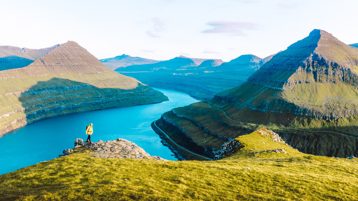
2. Lake Sørvágsvatn

The trek to Lake Sørvágsvatn is another thrilling adventure that gives you a glimpse of the Faroe Islands’ otherworldly scenery. Although the path isn’t constructed the entire length, it’s easier than hiking to the Kallur Lighthouse. Lake Sørvágsvatn is the largest lake in the Faroe Islands, but its claim to fame is the optical illusion it presents overlooking the ocean.
Miðvágur is the closest town to the trail, and clear signs point you in the right direction. The trailhead is about a 35-minute drive from Tórshavn, but it’s also right beside the Vagar Airport. If you fly to the Faroe Islands, this would be the best option for your first hike.
Start hiking towards the Trælanípa sea cliffs for the striking image of the lake’s illusion that earned it the nickname “Lake Above the Ocean.” Similar to other hiking trails in the Faroe Islands, proper hiking boots are a must for this path. The trail is often muddy, and there are several places where you will likely step in water.
It’s a gradual ascent to the sea cliffs, and the trail hugs the lake’s shoreline until you reach the iconic viewpoint. At the edge of Lake Sørvágsvatn, you’ll notice the Bøsdalafossur waterfall spilling into the Atlantic Ocean.
Make sure your camera is fully charged for this hike since the views of the lake and the wild Atlantic waves crashing into the rocky cliffs are astonishing. Although you could probably complete the loop in less than two hours, it’s easy to spend several hours here just admiring the views.
Must Read: Your Guide to the Sorvagvatn Hike
3. Slættaratindur

We attempted to make this ascent to the highest mountain in the Faroe Islands, but turbulent weather conditions held us back from the summit. It had snowed, and the frigid temperatures made the path extremely icy and slippery. A fall here would be life-threatening, so we just enjoyed the breathtaking views that overlooked the craggy mountaintops.
Unlike our hike in October, climbing to the summit should be a piece of cake during the summer months. It’s a local tradition to make this trek on June 21st, the longest day of the year, to watch the sunset and rise a couple of hours later. The mountain’s peak is 880 meters, and reaching the top takes you to the roof of the Faroe Islands.
If you’re staying in Tórshavn, it takes just under an hour of driving to reach the trailhead. Start at Eiðisskarð, the mountain pass between Eiði and Funningur, where you will climb over a fence in the parking area to begin the trek. After making a steady ascent, you begin to see the sharp mountain peaks that dot the archipelago.
The path isn’t difficult to find during the summer due to its popularity amongst locals and tourists, and you have several options to reach the summit. Stones are scattered everywhere, and you must be careful not to slip while scrambling to the mountaintop.
Standing on the flat summit of Slættaratindur gives you a bird’s eye view of the entire country and is nothing short of spectacular. It’s even possible to spot Iceland in the distance on a sunny day without a cloud in the sky.
4. Villingadalsfjall

This is when hiking in the Faroe Islands gets challenging, but the trek to Villingadalsfjall treats you to more breathtaking views. Situated on Vidoy, the northernmost island of the Faroe Islands, the coastal mountain poses one of the toughest one-day hikes in the country.
The hike begins in Viðareiði, possibly the most scenic village anywhere in the Faroe Islands. Although set in a remote part of the Faroe Islands, Viðareiði can be reached by car in only 1 hour and 30 mins from Tórshavn, thanks to causeways. Villingadalsfjall rises high above the village, and the nearby Cape Enniberg is one of the world’s highest sea cliffs.
To find the trailhead, look for a rock wall along the road called Við Garð and blue plastic tubes that mark the path. There is a parking lot just beyond the gate that leads to a grassy field. The first section of the trail is an easy stroll through the grass, but you’ll gradually gain elevation.
Eventually, the blue plastic tubes end, and a group of cairns veer to the west. DO NOT follow the cairns since they will lead you to Enniberg, and it’s highly recommended you hike with a local guide to the sea cliffs.
Stay on the same path until you find a sign marked Torratindur that indicates the summit of Villingadalsfjall. From the mountaintop, admire the unbelievable panorama of the other peaks that dot the northernmost islands of the archipelago.
Altogether, the ascent to the summit is over 2,400 feet, and you’ll need proper hiking boots due to loose rocks. Once you’re finished soaking up the views, the same route takes you back downhill to Viðareiði.
5. Á Hálsi við Sandavág Slættanes Fjallavatn Gásadalur

Spanning nearly 20 miles across the island of Vágar, this trip takes you off the beaten path to some of the most beautiful areas of the Faroe Islands. The route shows you how the locals traveled from village to village centuries ago and reveal stunning images of the landscape. From isolated communities to surreal bird cliffs, the ancient cairn path feels like you’re hiking inside a time portal.
The difficult journey starts at the parking lot á Hálsi and ventures to a gorge called Ravnagjógv where the cairn path begins. As you trek past the Skælingur, Leynar, and Kvívík villages, the trail opens up to stunning views of the mountains. Be careful not to lose sight of the route you’re on since venturing off the cairn path will lead you towards the mountains.
Eventually, you will wander into the abandoned village of Slættanes and towards the Vestmanna bird cliffs. During the summer, these cliffs provide a sanctuary for sea birds such as puffins and guillemots, and they’re a popular boating excursion for tourists. The route hugs the cliffside and gives you a picturesque view of Mýlingur, one of the most uniquely shaped mountains on the Faroe Islands.
Make sure to have your camera ready for the remainder of the hike as you pass several of the most photogenic sights of the Faroe Islands. Snap photos of Árnafjall, the remote village of Gásadalur, and gaze at the Mykines Island across the water.
Due to the long distance of this hike, it’s crucial to pack enough food for the trip. It also presents a fantastic opportunity to sleep beneath the stars if you bring along your camping gear.
For more information about this hike check out this detailed hiking guide for the Faroe Islands
Faroe Islands hiking tours
Looking for guided hiking tours of the Faroe Islands, take a look at guide to Faroe Islands for a nice overview of hiking tours. More into other activities see my favourite tour below.
FAQ hiking Faroe Islands
Is wild camping allowed in Faroe Islands?
As all the land in the Faroe Islands is private property, wild camping is strictly forbidden. If you want to camp, please always ask the landlord permission to put your tent.
How many days is enough for Faroe Islands?
How many days you need on the Faroe Islands really depends on what you want to do, but I would suggest a minimum of 4 days and 7 days when you want to do some hiking or boat/helicopter trips.
What is the best month to visit the Faroe Islands?
The period between May and August is the best to visit the Faroe Islands. As there are a lot of birds, wildflowers, nicer weather conditions and the evenings are light.
Pin for later


Thanks for checking out our top 5 most incredible hikes of the Faroe Islands. Hopefully, this has provided the information you need for an epic trekking adventure in this exhilarating travel destination. If you have tackled any of these hikes before, or if you have a question, please leave a comment below.
Are you ready to discover more about the Faroe Islands? Check out our Faroe Islands page to read all our articles.